Log in
All resources
Create a design
52,119 Free Images of Old Celestial Maps
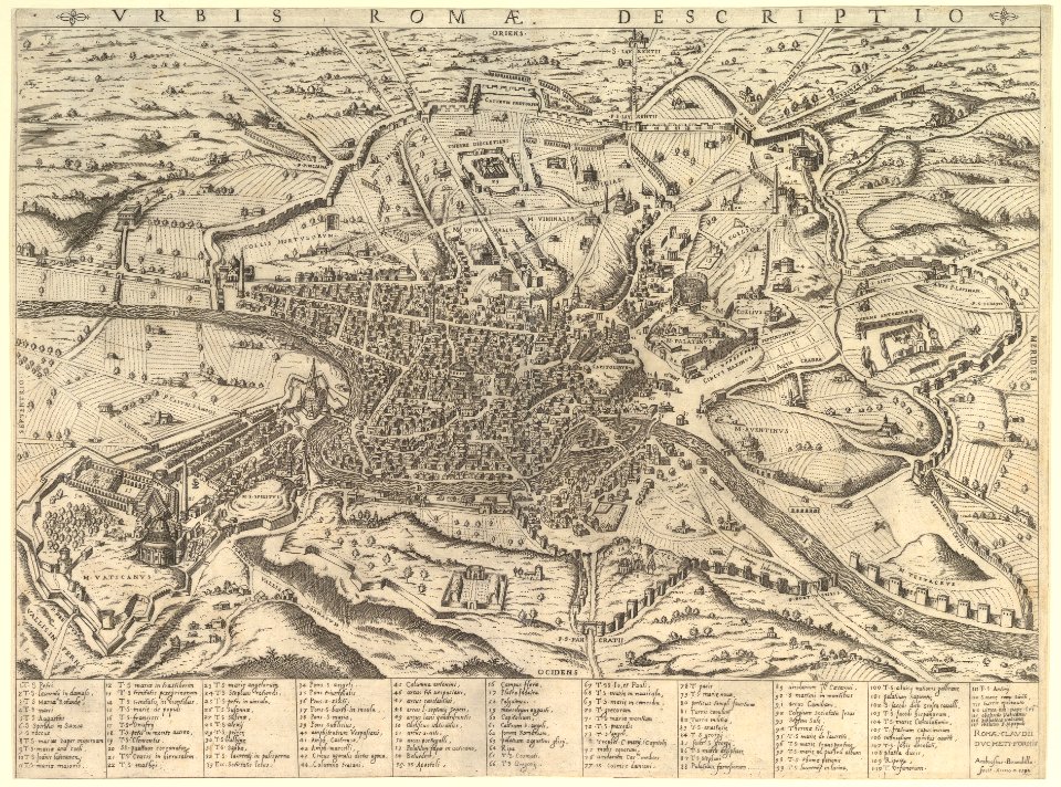
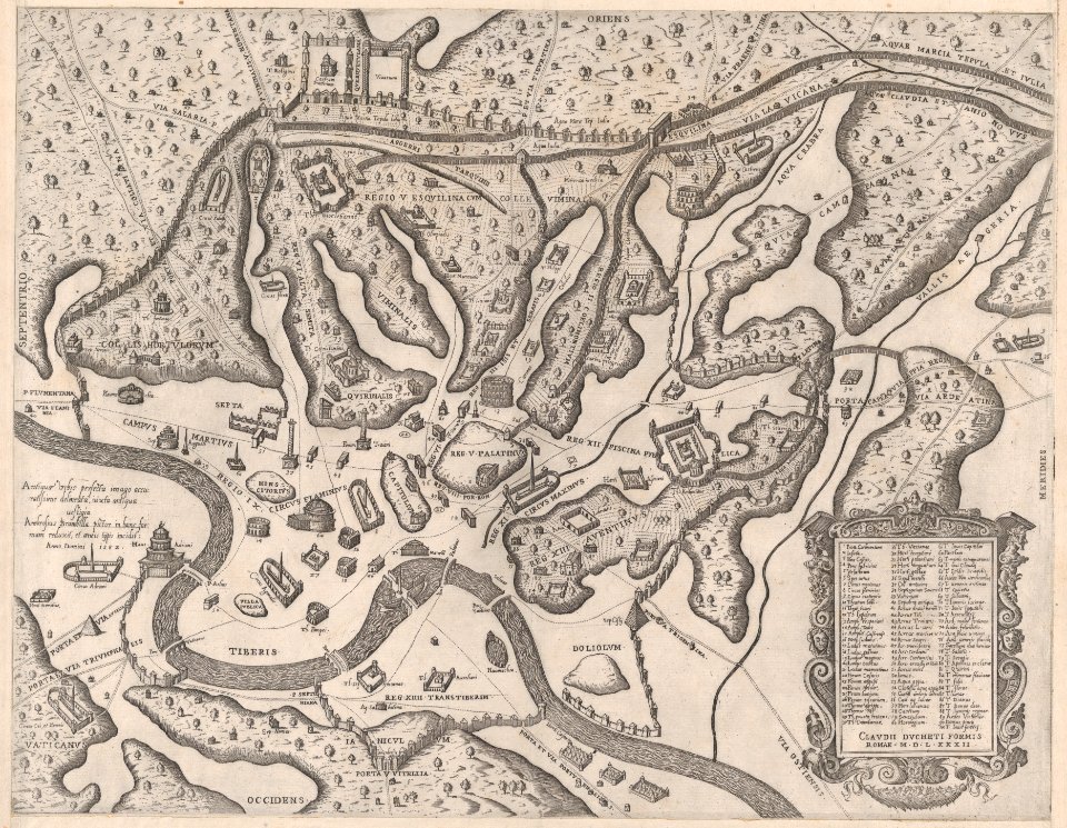
maps in the library of congress
pennsylvania
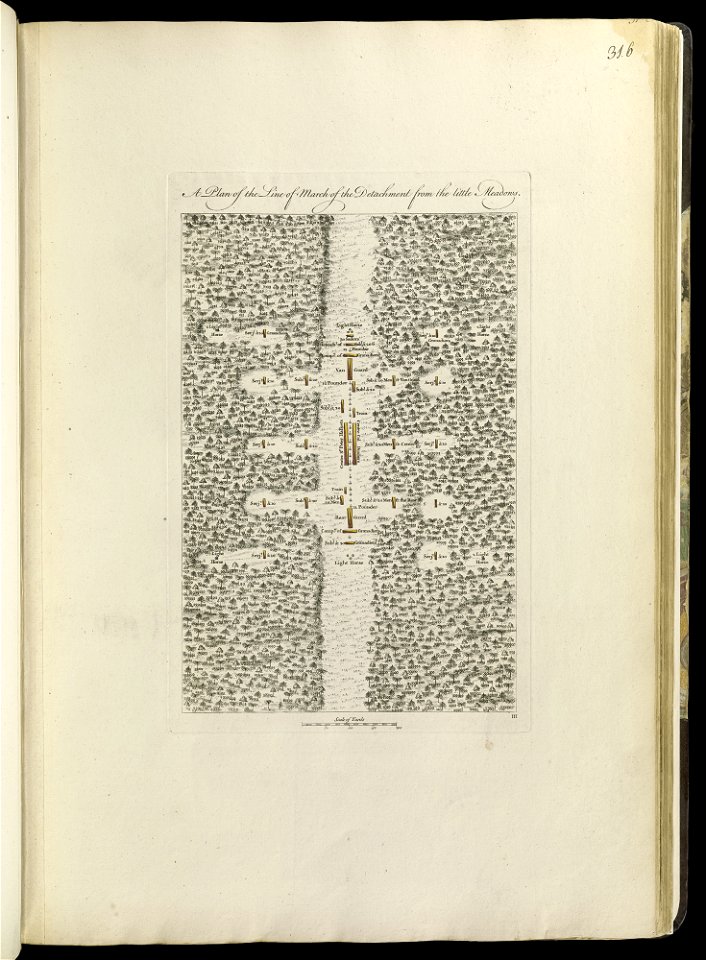
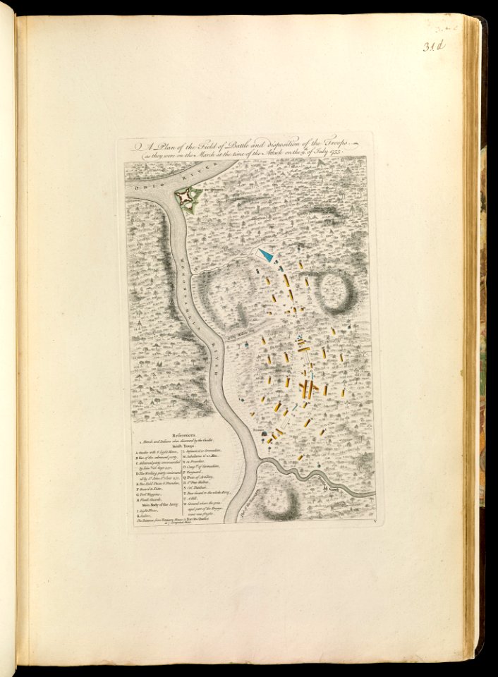
maps of the french and indian war
braddock road (braddock expedition)
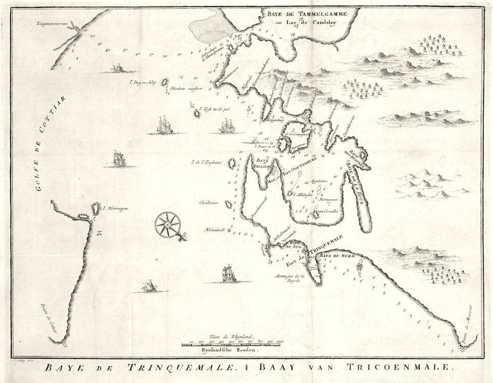
maps of the dutch east india company - sri lanka
1897 maps of allegheny county
1768 maps
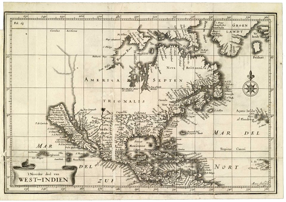
maps of the west-indische compagnie
charts and maps of the royal museums greenwich
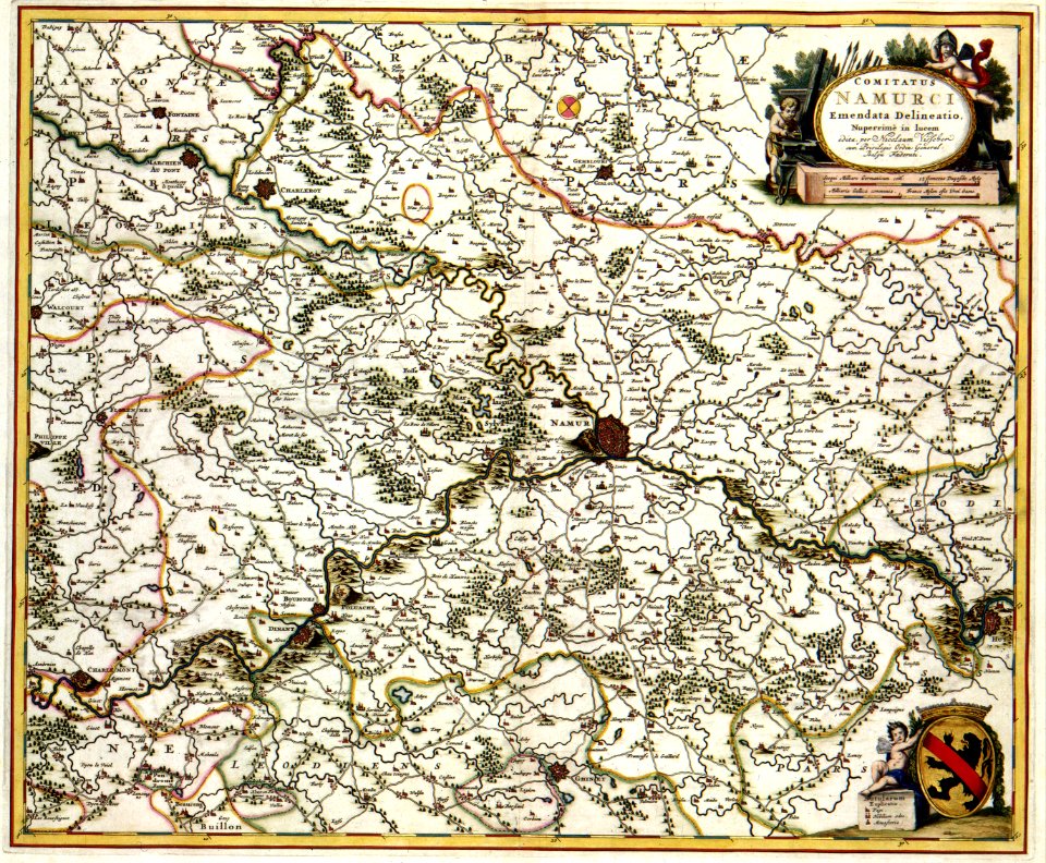
maps with cartouches
paintings by isaac israëls in the rijksmuseum amsterdam
processions in art
17th-century paintings in the old belarusian history museum
17th-century icons of belarus
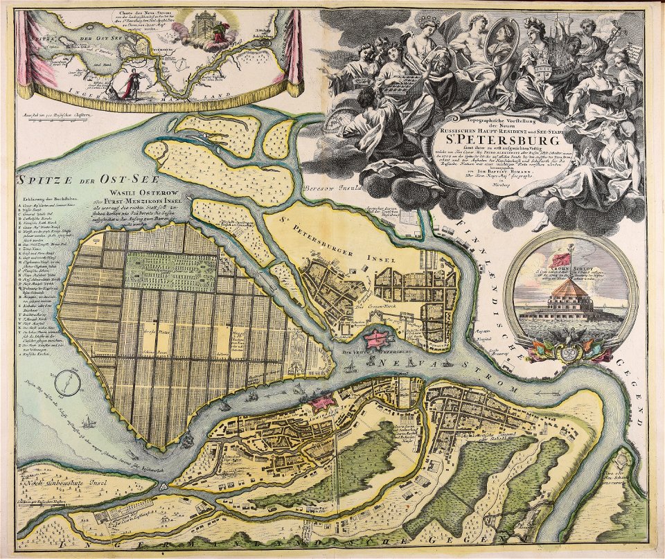
homann map st petersburg ab1720
johann baptist homann
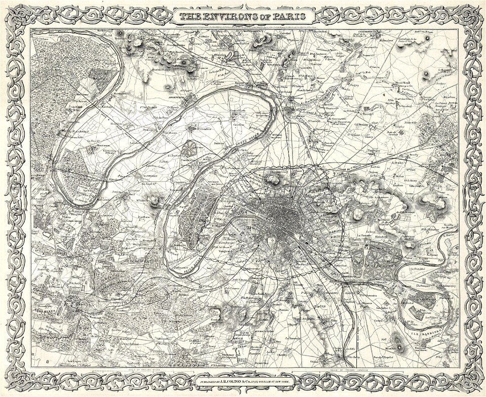
1855 in paris
1855 maps
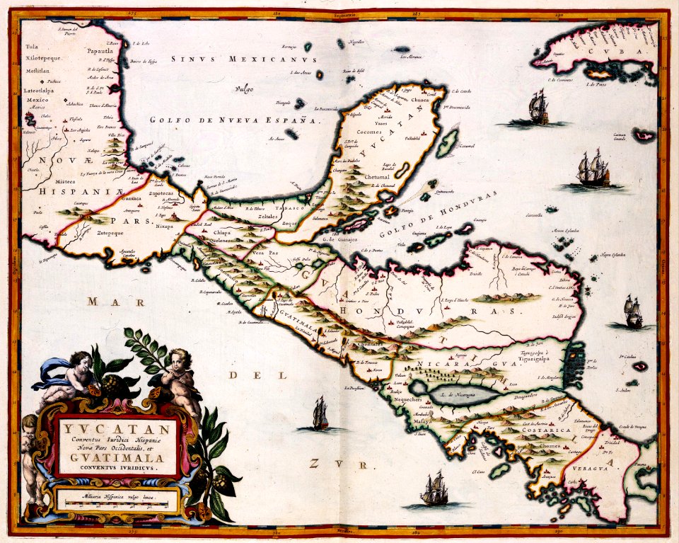
maps of the yucatan peninsula
maps with cartouches
maps in the library of congress
new york
old testament paintings in the hermitage
1630s paintings in italy
1670s paintings in unidentified private collections
17th-century paintings of dogs
artworks without wikidata item
rogers fund
artworks without wikidata item
rogers fund
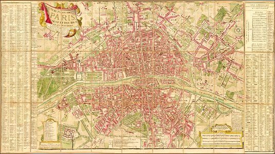
maps of paris from the barry lawrence ruderman antique maps inc.
18th-century maps of paris
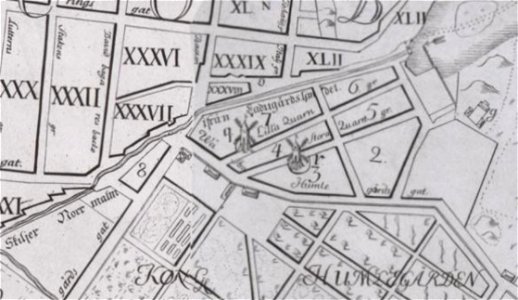
windmills in stockholm
maps of östermalm
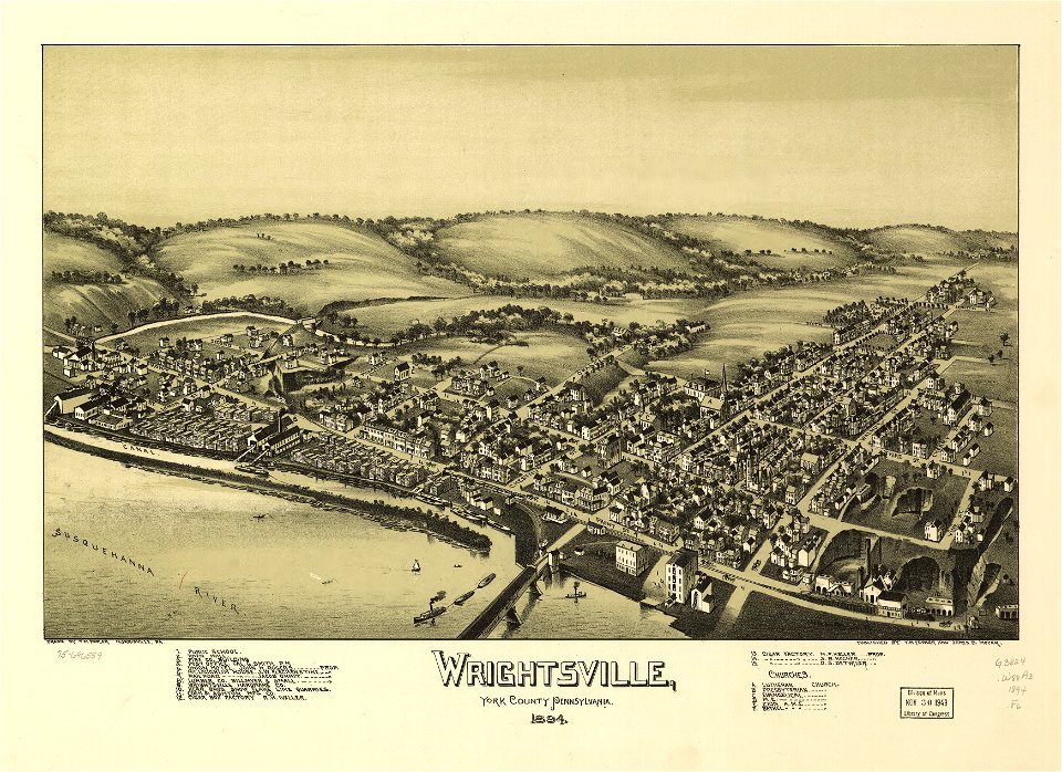
pennsylvania
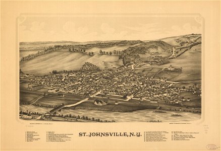
wrightsville
maps in the library of congress
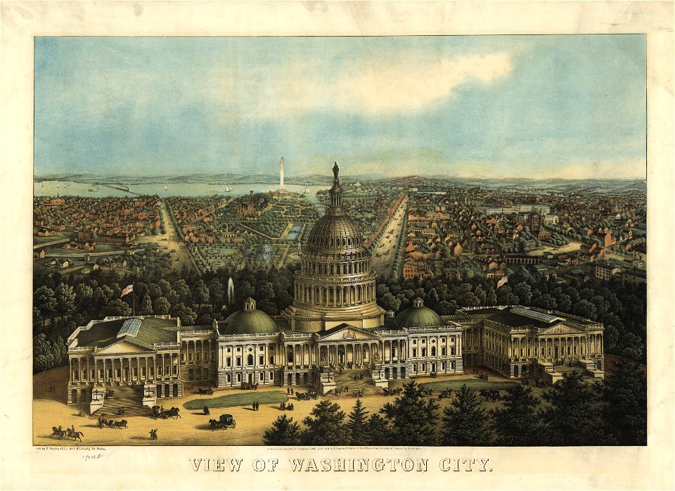
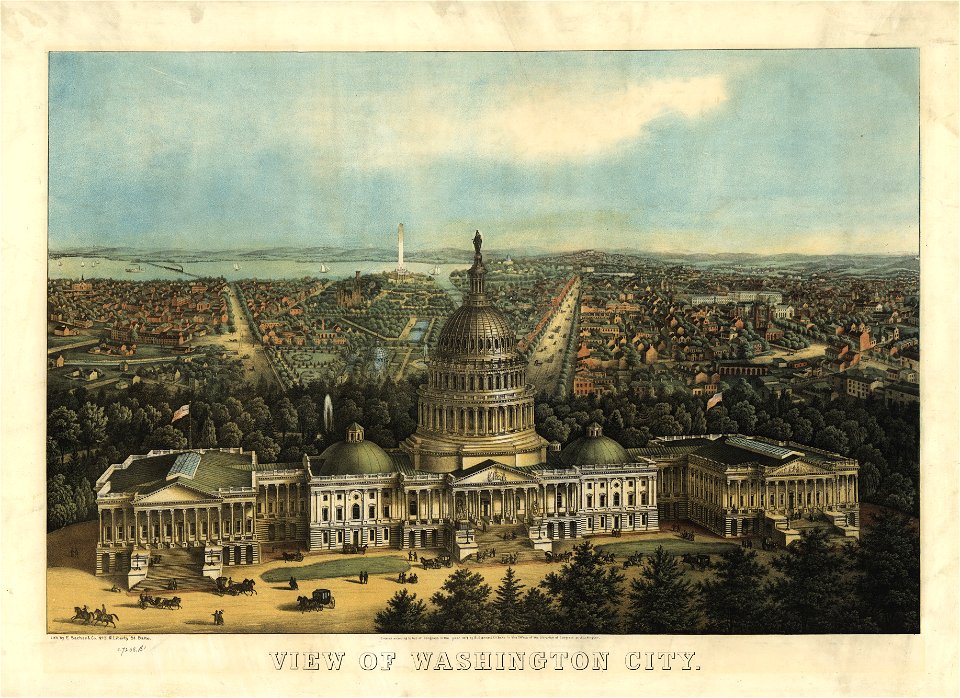
united states capitol in art
maps in the library of congress
o. h. bailey
maps in the library of congress
united states capitol in art
pennsylvania
wrightsville
maps in the library of congress
o. h. bailey
maps in the library of congress
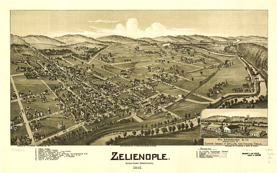
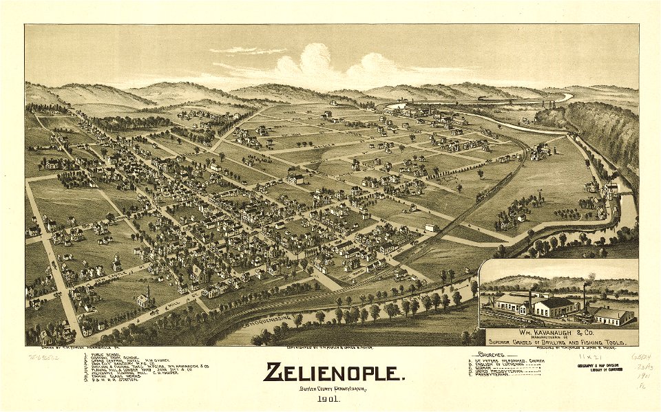
pennsylvania
maps in the library of congress
pennsylvania
maps in the library of congress
pennsylvania
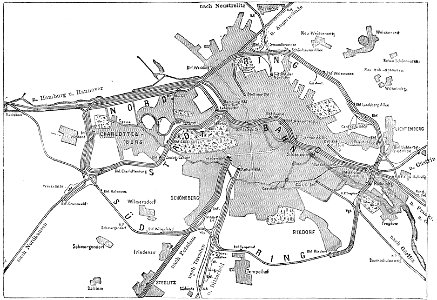
19th-century maps of berlin
maps by brockhaus
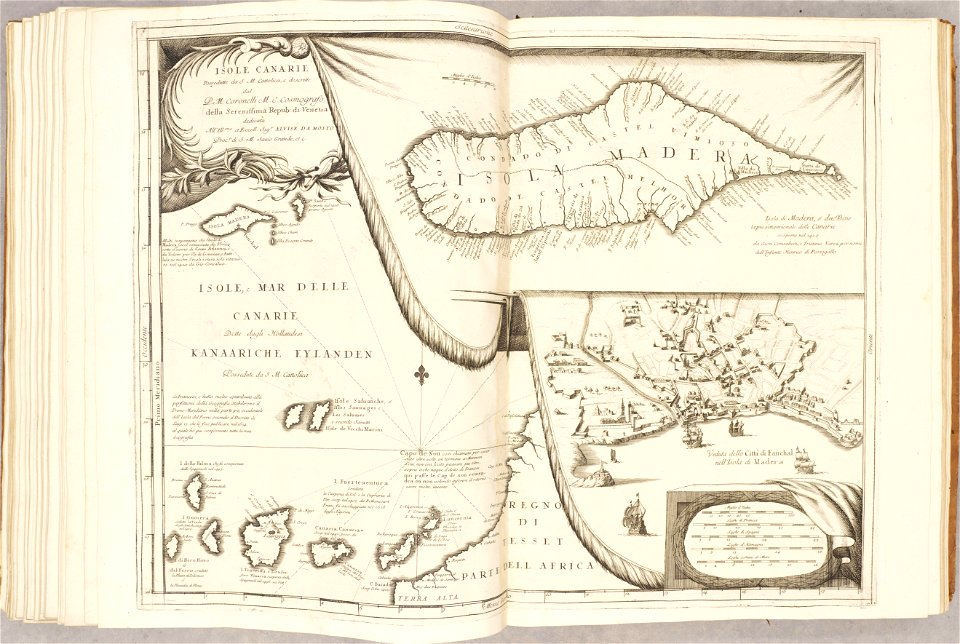
atlante veneto (raremaps.com) volume 2
maps of milan
atlante veneto (raremaps.com) volume 2
canary islands
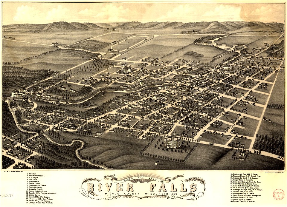
river falls
wisconsin
maps in the library of congress
pennsylvania
river falls
wisconsin
maps in the library of congress
pennsylvania
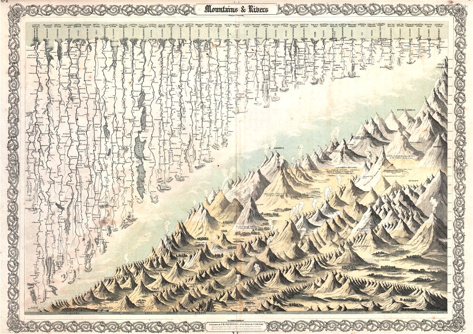
geographic comparison diagrams
diagrams of mountains
the illustrated london news 1878
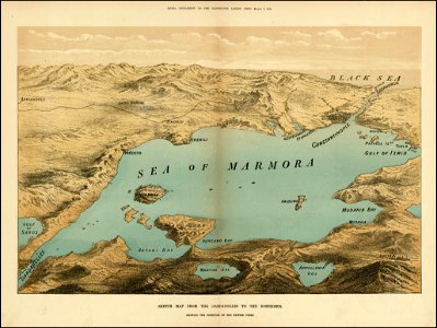
maps of the sea of marmara
hill of tara
1879 maps
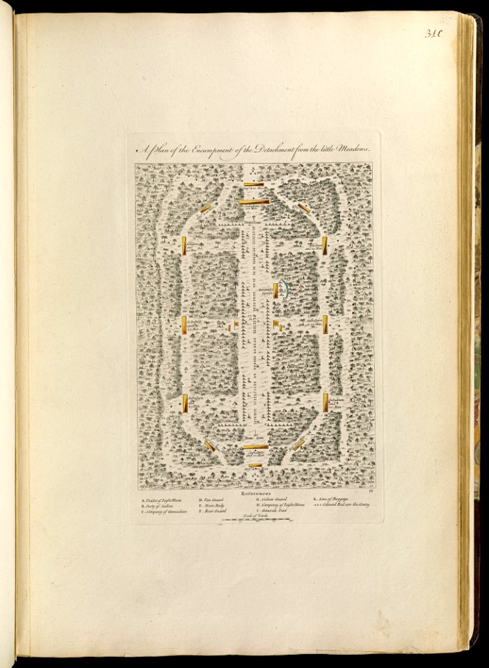
maps of the french and indian war
1768 maps
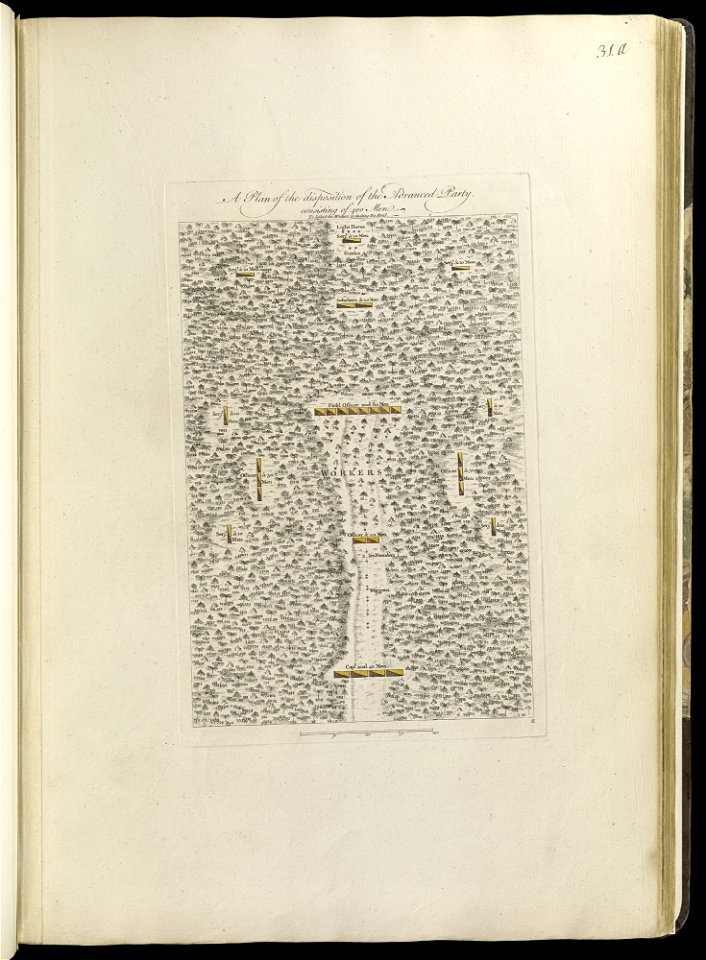
maps of the french and indian war
1768 maps
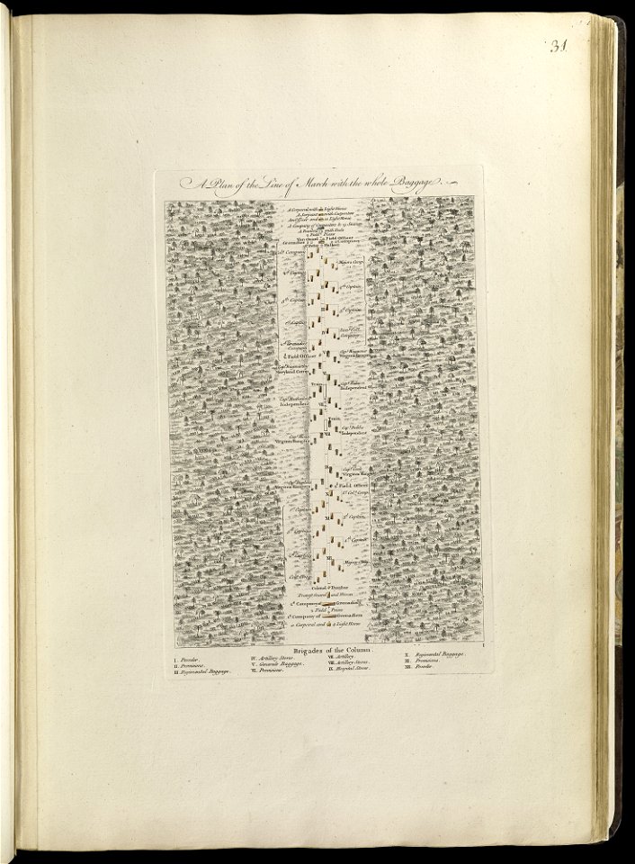
maps of the french and indian war
1768 maps
maps of the french and indian war
1768 maps
maps of the french and indian war
1768 maps
maps of the french and indian war
1786 maps
maps of the french and indian war
1768 maps
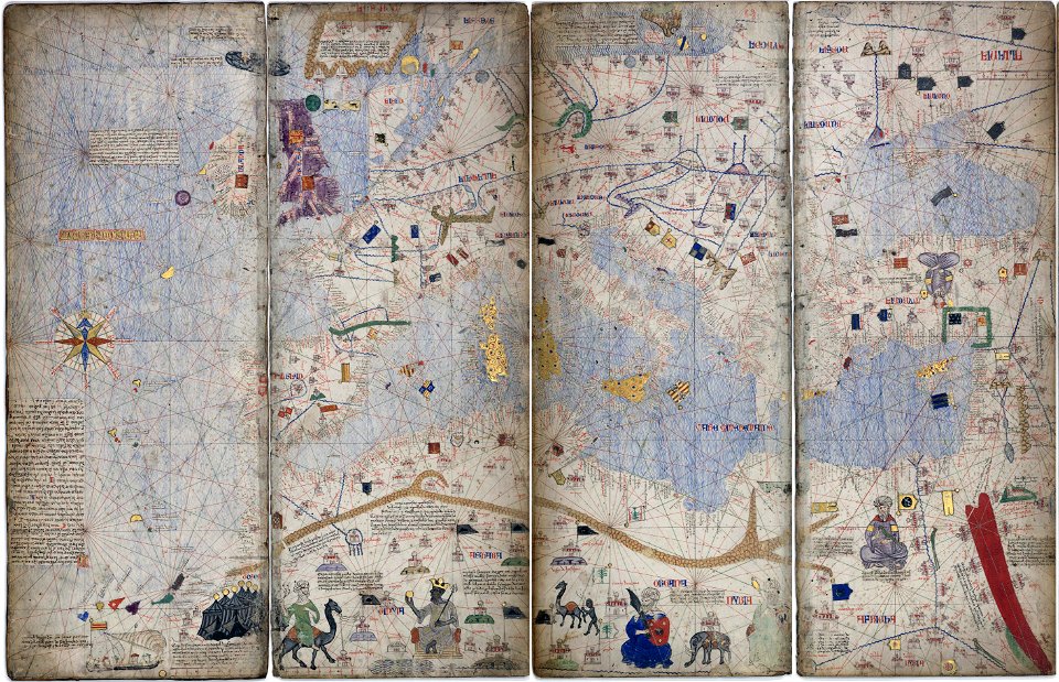
14th-century maps of the mediterranean sea
catalan atlas
14th-century maps of the mediterranean sea
catalan atlas
atlas van der hagen (volume 2)
maps with cartouches
dutch-language maps
johannes ratelband
latin-language maps
1630 maps
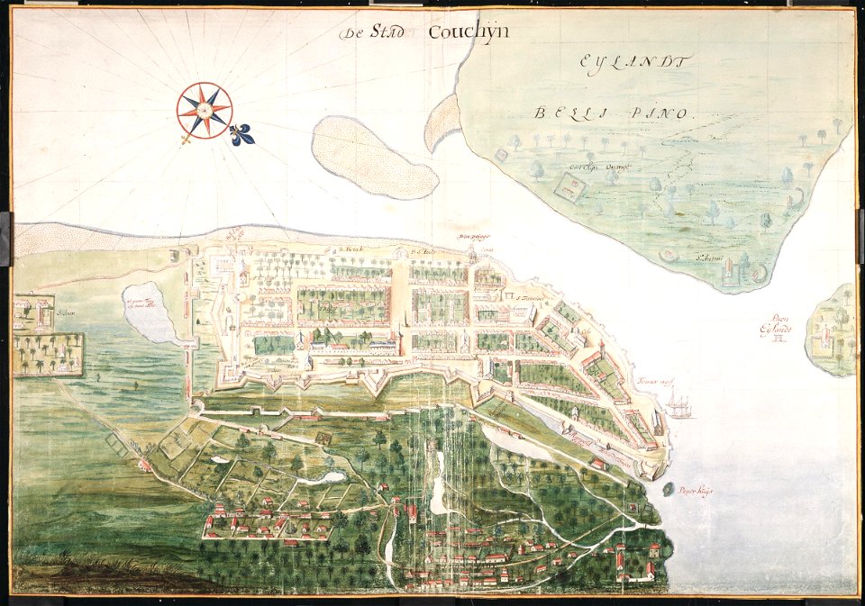
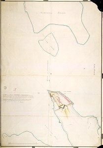
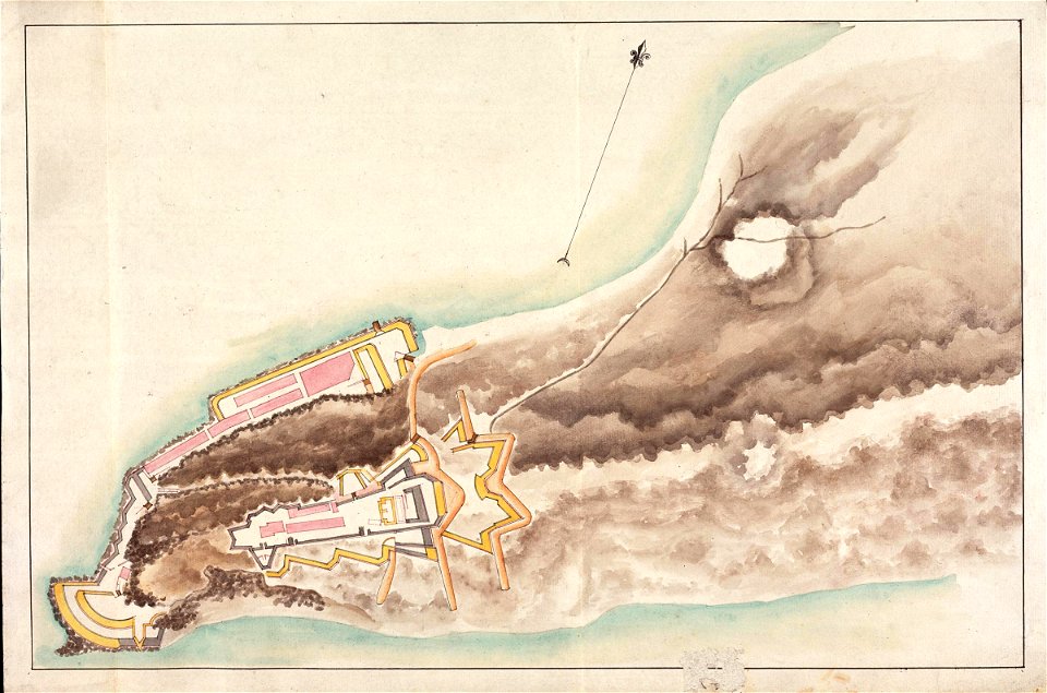
maps of the dutch east india company - sri lanka
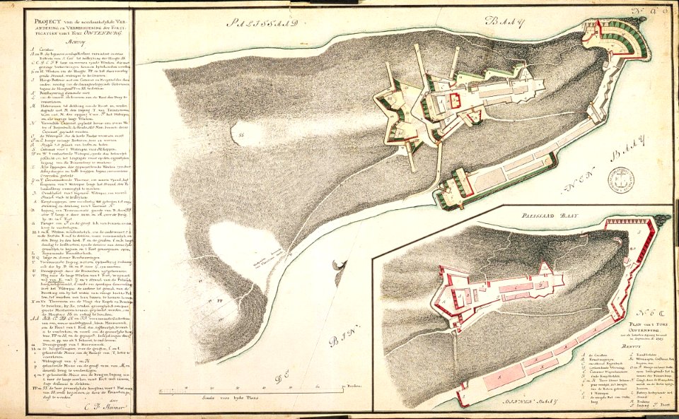
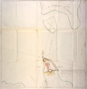
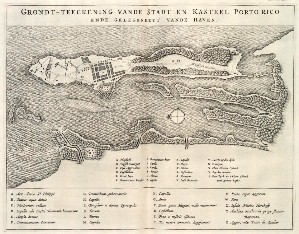
maps of fort fredrick
maps of the dutch east india company - india
1665
maps of the dutch east india company - sri lanka
1787
maps of the dutch east india company - sri lanka
1787 maps
maps of the dutch east india company - sri lanka
maps of fort fredrick
maps of the dutch east india company - sri lanka
1787
maps of the dutch east india company - sri lanka
maps of fort fredrick
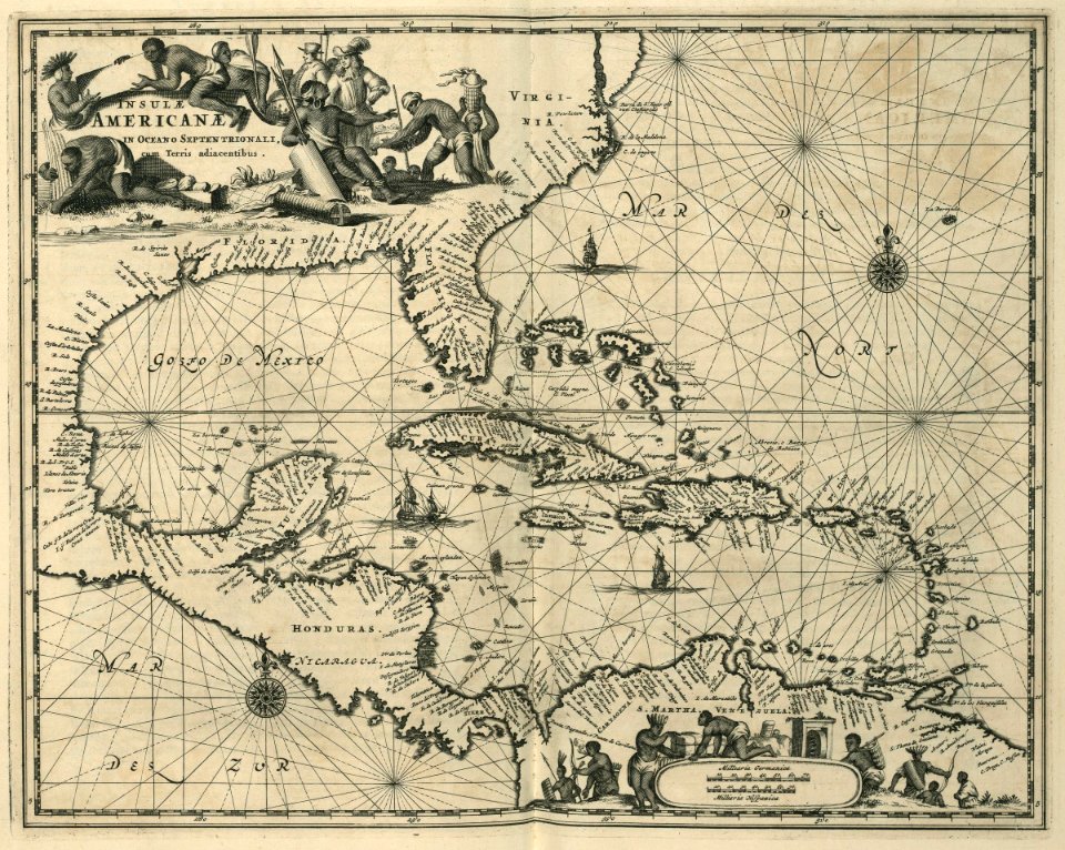
17th-century maps of the caribbean
1671
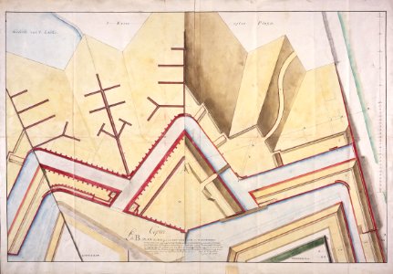
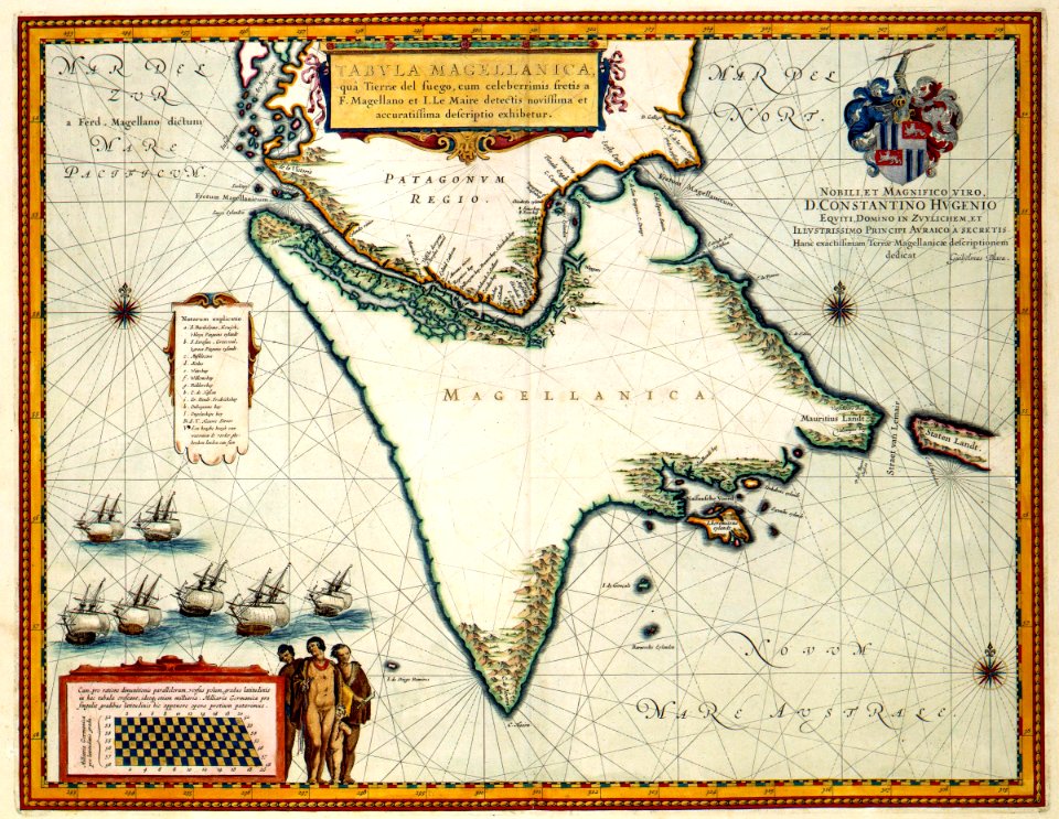
maps of the west-indische compagnie
1644
maps by willem and johannes blaeu
1635 maps
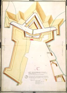
maps of the west-indische compagnie
1777
maps of the west-indische compagnie
abraham goos
maps of the dutch east india company - sri lanka
1753 maps
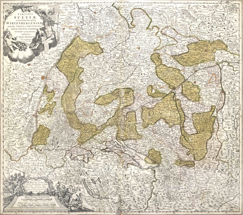
1720s maps of baden-württemberg
johann baptist homann
maps by frederick de wit
copper engraving
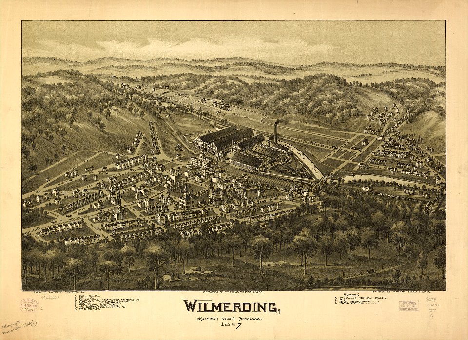
pennsylvania
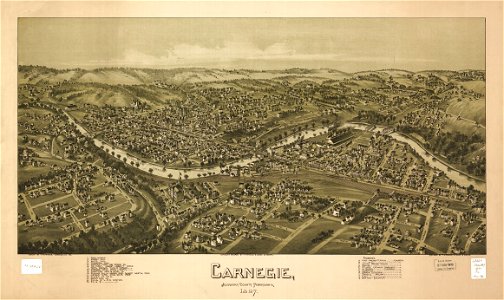
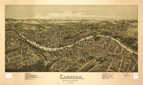
carnegie
pennsylvania
carnegie
pennsylvania
carnegie
pennsylvania
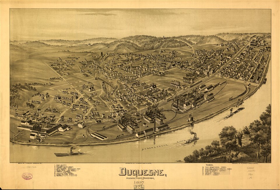
duquesne
pennsylvania
duquesne
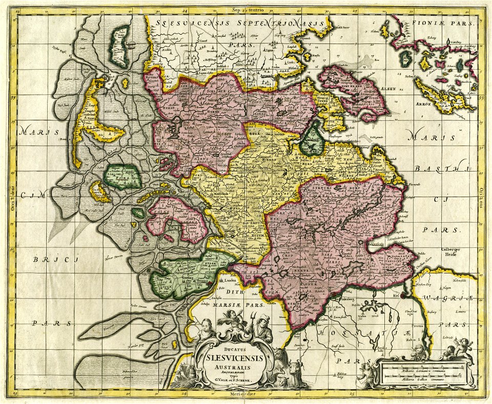
17th-century maps of schleswig-holstein
gerard valck
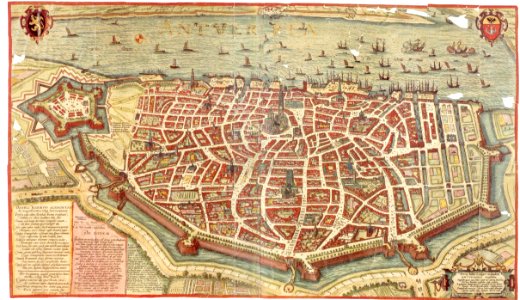
maps and topographical views by joris hoefnagel
maps of antwerp
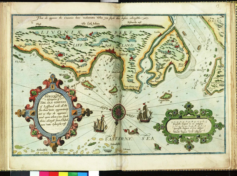
lucas janszoon waghenaer
1588 maps
lucas janszoon waghenaer
1588 maps
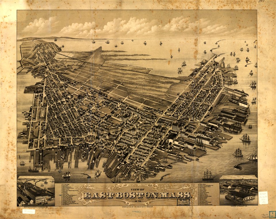
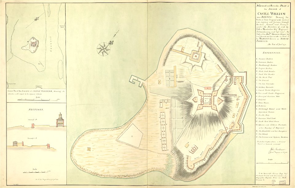
fort independence (massachusetts)
maps in the library of congress
massachusetts
o. h. bailey
1680s maps of baden-württemberg
1681 maps
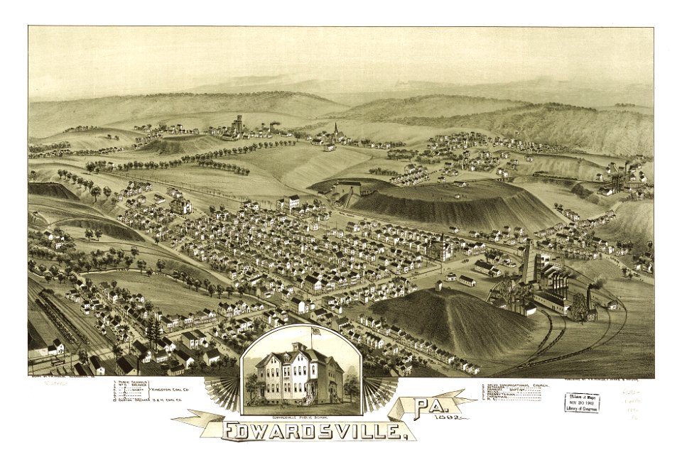
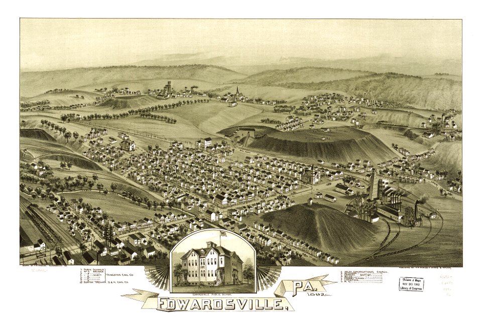
pennsylvania
edwardsville
pennsylvania
edwardsville
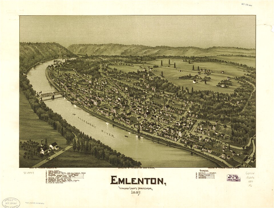
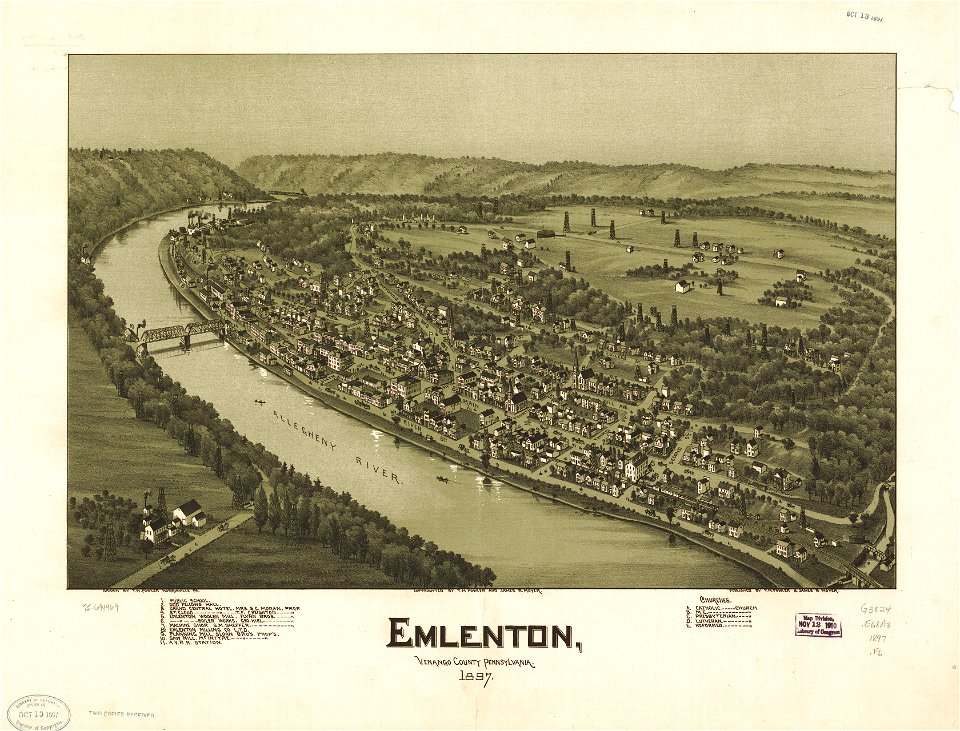
maps in the library of congress
pennsylvania
maps in the library of congress
pennsylvania
maps in the library of congress
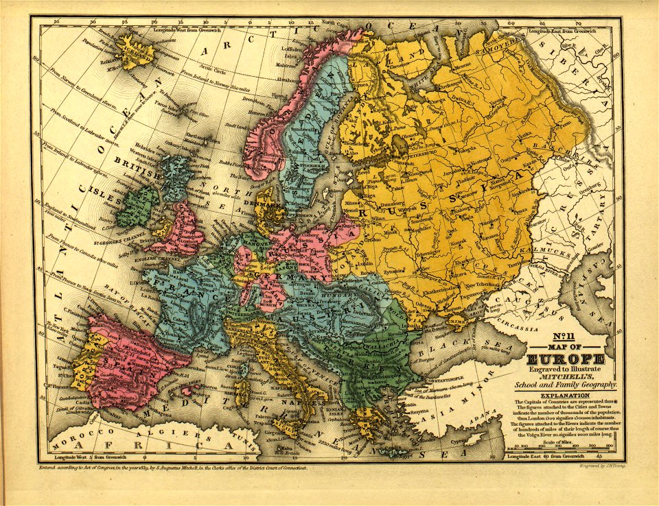
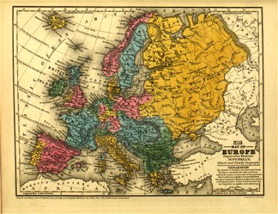
mitchell's school atlas
maps in the library of congress
mitchell's school atlas
17th-century maps of ethiopia
description de l'universe
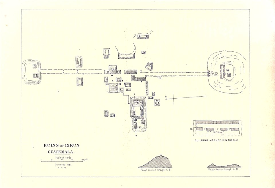
maps of the mayas
1899 books
pennsylvania
ford city
maps of paris by braun & hogenberg
maps of paris from paris musées
maps by pieter pourbus
1570s maps
geographical illustrations by coronelli
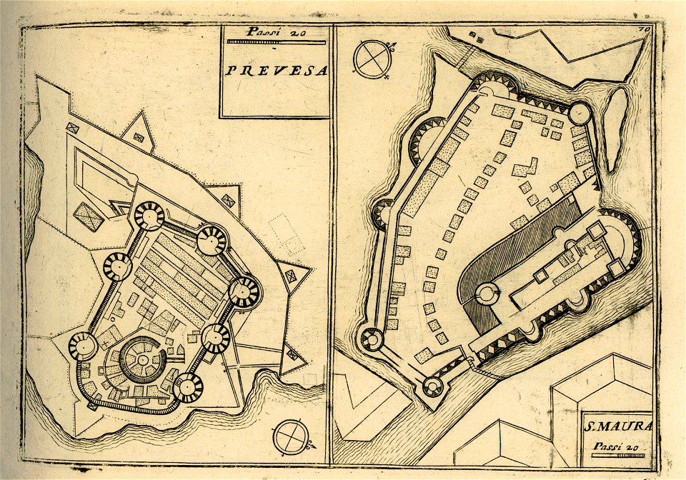
maps of lefkada
maps of paris by braun & hogenberg
maps of paris from paris musées
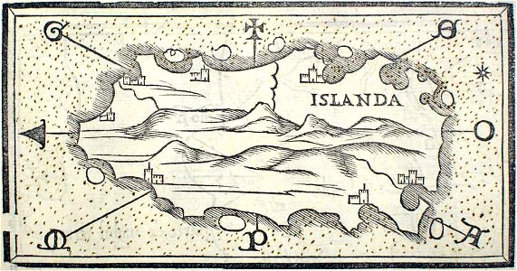
provided by landsbókasafn íslands
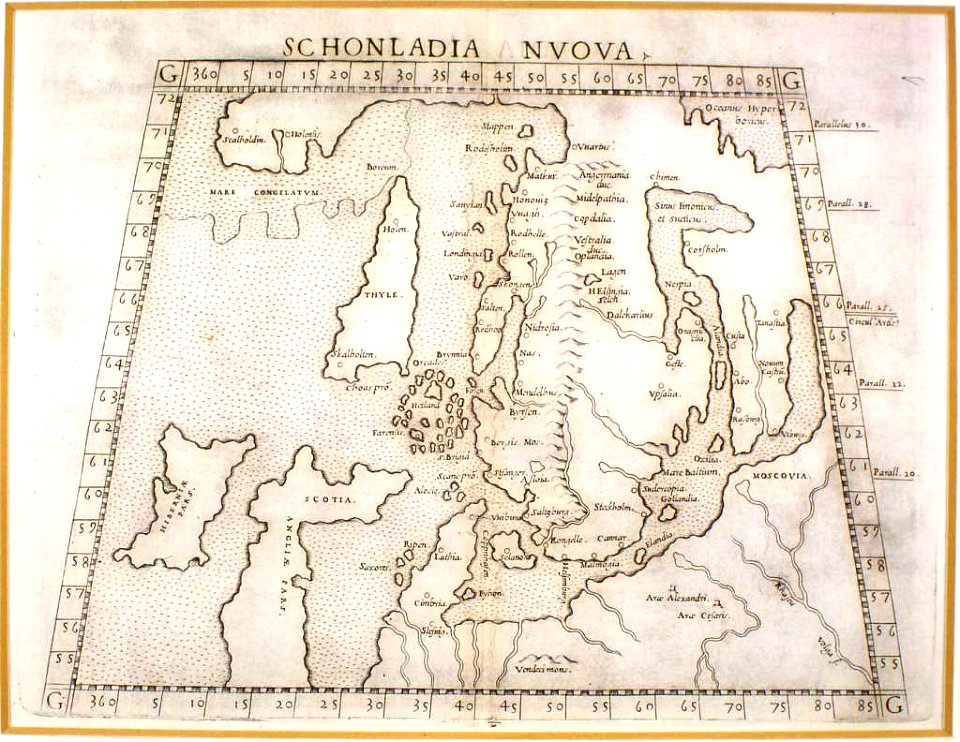
maps by giacomo gastaldi
provided by landsbókasafn íslands
16th-century maps of iceland
atlas of the russian empire (1800)
maps of volyn governorate
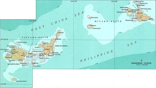
national atlas maps of occupied ryukyu islands
maps of sakishima islands
pennsylvania
sheffield
pennsylvania
sheffield
provided by landsbókasafn íslands
maps by giacomo gastaldi
16th-century maps of the caribbean
theodor de bry
lucas janszoon waghenaer
1588 maps
charts and maps of the royal museums greenwich
1682 maps
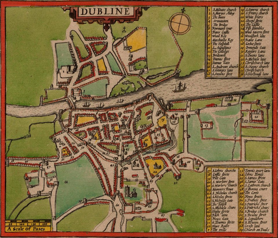
st mary's church
dublin
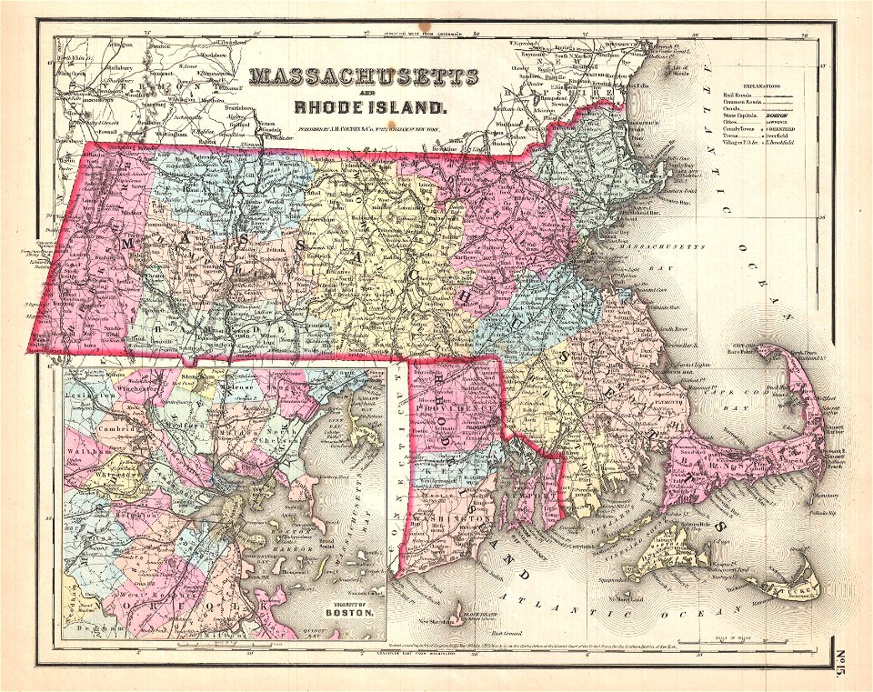
maps by joseph hutchins colton
1857 maps of massachusetts
atlantis magni tomus quintus (biblioteca comunale di trento)
maps made in the 18th century
maps with cartouches
atlas van der hagen
dutch-language maps
johannes ratelband
hatched coats of arms
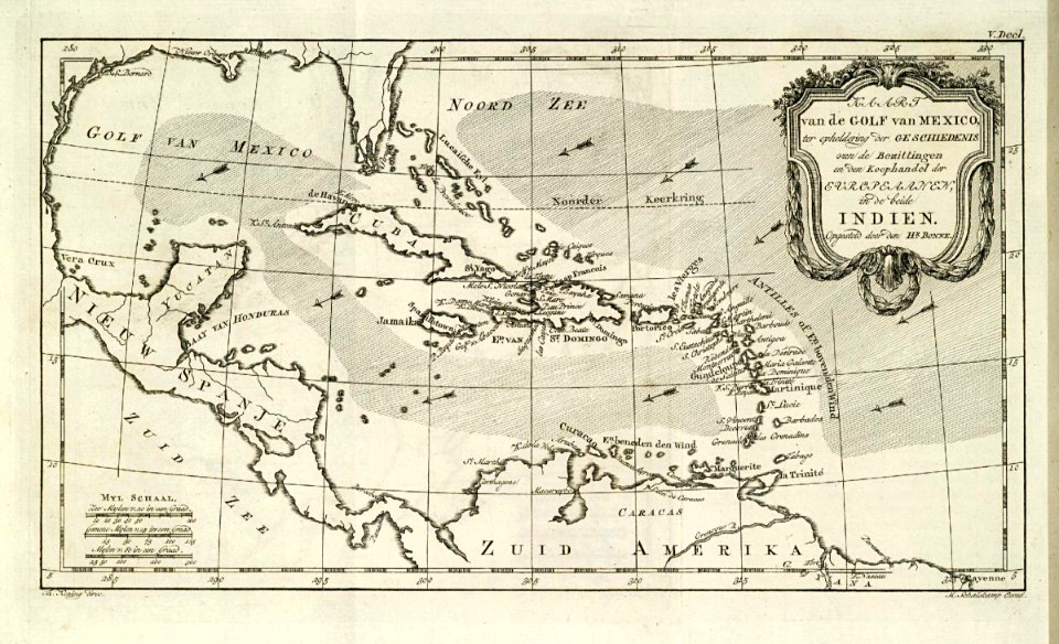
atlantic ocean
maps made in the 17th century
maps by nicolaes visscher i
7801 - 7900 of 52,119
Next page
/ 522